b2OeUuOR6l
09 February 2022
No Comments
Geography of Mystras
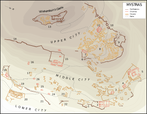
 Mystras is situated on the slopes of Taygetos Mountain. The archaeological site stands above the modern village of Mystras and the city of Sparti. The greenery surrounding the area is composed mainly by pine trees and cypresses. Some small rivers and lakes are found in the region.The final straw to Mystras came in 1823 during the Greek war of Independence when Egyptians under the rule of Ibrahim massacred the local population and destroyed the local area.[11] The town was rebuilt 9 km away under the name Sparti in 1831. Most families moved to Sparti, but a few decided to move instead to New Mystras, a small village in the countryside. This process of relocation was completed in 1953 when the remaining properties were confiscated by the municipality. In 1989 the ruins, including the fortress, palace, churches, and monasteries, were named a UNESCO World Heritage Site and features a museum and the partially restored ruins of the city. The only inhabitants today are a group of nuns who reside in the Pantanassa Monastery. The majority of the most important churches are still standing, including St. Demetrios, the Hagia Sophia, St. George, and the Monastery of Peribleptos. The Palace of the Despots has undergone substantial restorations in the past decade, making it a significant attraction. Visitors can reach the ruins via the modern city of Sparti, which is only a few miles from Mystras.
The municipal unit Mystras is subdivided into the following communities:
- Agia Eirini
- Agios Ioannis Lakedaimonas
- Anavryti
- Barsinikos
- Longastra
- Magoula, the municipality seat of Mystras.
- Mystras
- Paroreio
- Soustianoi
- Trypi